 It is undeniable that in the last few days the mathematical models have heavily changed the climatic weather trend for the first decade of November.
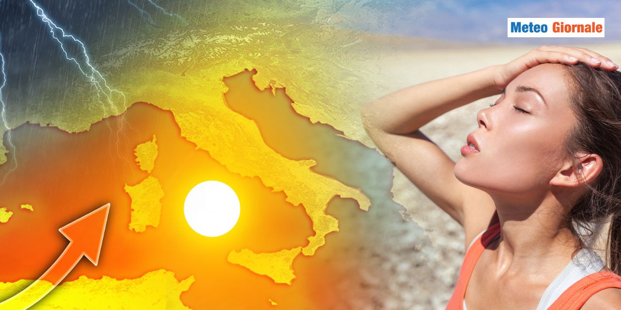
Initially, a further deterioration of the atmospheric picture was hypothesized due to a cold incursion from the Arctic Circle, then we identified the model shift towards the African Anticyclone. Anticyclone that is already taking over, putting an end to the cyclonic assault that once again caused flood rains in some regions.
In others, on the contrary, the anticyclonic ridge had already taken over during the weekend and now that the influence of the Iberian depression is no longer there, the weather has significantly improved everywhere. Atmospheric stability will persist for a long time, apparently for most of the first decade of November.
What worries is the so-called “Omega block” that could establish itself over central-western Europe, that is, a massive High Pressure wedged between two equally important depressionary circulations: one in the middle of the Atlantic, the other over eastern Europe. Blocks of such magnitude, statistics say, are difficult to dislodge. Their demolition will require a lot of energy, but at the same time, we are aware that usually such a synoptic prelude to profound circulatory changes. Nothing strange, therefore, if after the anticyclonic phase we will have to deal with the first taste of Winter. This is to tell you that the Arctic incursion at the beginning of the month has indeed been canceled, but it may have simply been postponed. When? Let’s say that by mid-month that profound change in continental atmospheric circulation could occur, and in this sense, it will be very important to follow the evolution of the Polar Vortex. Until then, however, you will hear us talk about mild weather, temperatures above seasonal averages, thermal inversions, and nighttime cold.
In short, we will talk about the typical climatic weather conditions of such a structured anticyclonic phase. Thermal anomalies will be more significant in the South and between the two Major Islands, where highs could reach – if not locally exceed – peaks of 25°C.
In the Center-North, we expect more contained daytime temperatures, but equally capable of approaching 20°C. As mentioned, the nighttime hours will bring sometimes heavy thermal inversions, therefore it will be decidedly colder and the cold will be responsible for the development of thick fog banks between plains, valleys, and even some coastal areas.
Fogs that locally, especially in the Po Valley, will be able to persist even during the day. In short, we are about to face a typical autumn anticyclonic phase, although it is not the Azores High but the subtropical anticyclonic structure.
For the change, we will have to be patient, hoping that thermal excesses do not translate – once again – into subsequent pluviometric excesses.

WEATHER for the next 15 days mild with the African Anticyclone. Possible changes around November 10th
Our articles from Meteo Giornale are on Google News, follow us for free!


