
WEATHER UNTIL DECEMBER 12, 2024, ANALYSIS AND FORECAST
A depression vortex is currently influencing the weather in Italy, with widespread precipitation in the South and also sustained winds in many regions. The air currently flowing into Italy is not particularly cold like the one that will break in over the weekend.
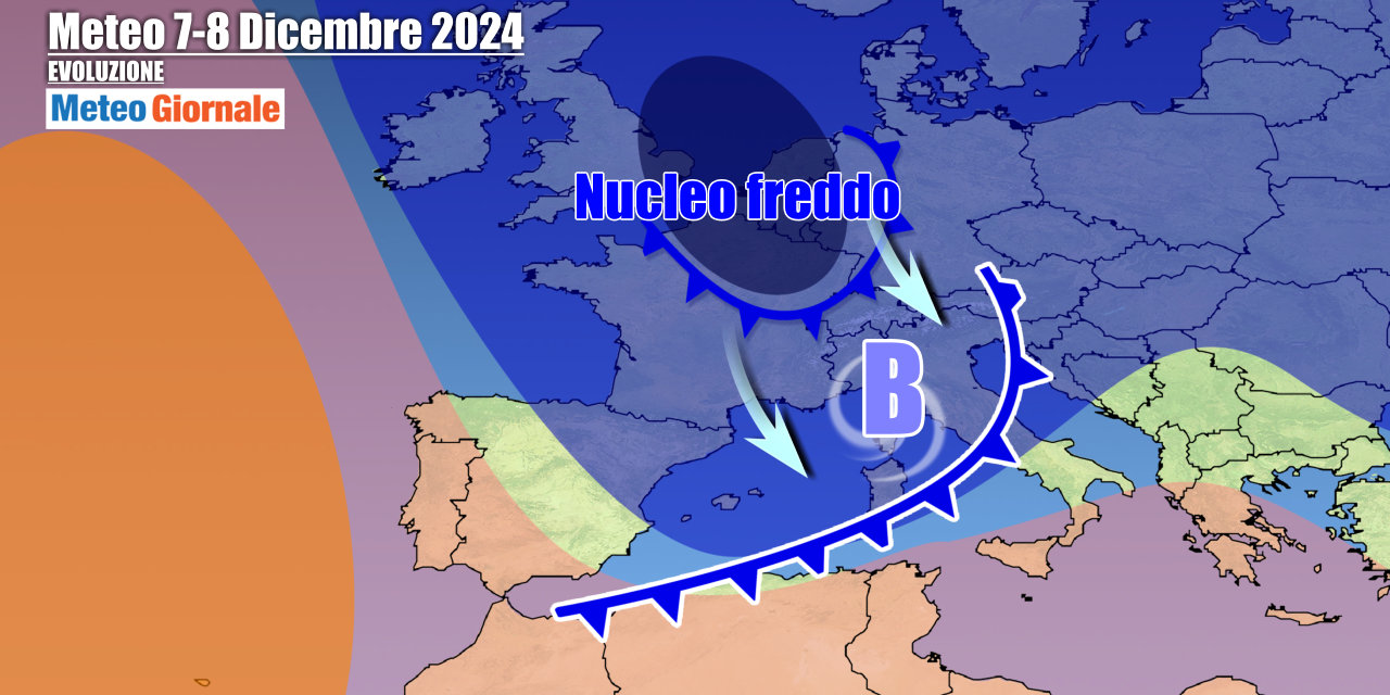
The pressure minimum will move away on Friday, December 6 towards the Libyan Sea, thus exiting the scene. The respite will last for a short time, as a new deep cyclone will develop over the United Kingdom, ready to plunge south and also reach the Mediterranean, bringing a mass of Arctic and polar air drawn from the Norwegian Sea. The polar-origin cold front will come into play right between Saturday and Sunday, causing a vigorous wave of bad weather. The descent of cold currents over more than half of Europe will be triggered by the expansion northward of the Azores High towards Iceland.
Winter is therefore ready to manifest itself with the contribution of a deep depression, which will position its core over our regions, also favoring windstorms and heavy showers, in addition to rain showers and thunderstorms. The arrival of cold air will bring snow down to very low or hilly altitudes first in the North, where the phenomena will be sporadic, and then in the central regions where instability will be more marked.
In the South, it will snow at higher altitudes up to the low mountains. This winter phase should drag on into the first part of next week, with the vortex still active.
IN DETAIL
Friday, December 6: residual showers in the South, between Salento in Puglia, the Ionian Calabria, and Eastern Sicily.
Initially sunny or partly cloudy elsewhere with snow on the border Alps due to the approaching disturbance from the north.
Some light rain arrives in Liguria and Sardinia. Saturday, December 7: during the day, it worsens starting from the North with rain in the plains and snow in the Alps, which will descend to even low altitudes by evening.
It worsens in Sardinia and the Tyrrhenian regions. Sunday, December 8: marked instability in the Center-South and part of the North-East, snow down to the hills. Further weather trends: still rain, wind, and snow in the first days of the week, with the cold depression evolving into a Mediterranean cyclone. Temperatures will slowly rise by a few degrees.


