
 On the European chessboard, the atmosphere is divided into two distinct areas.
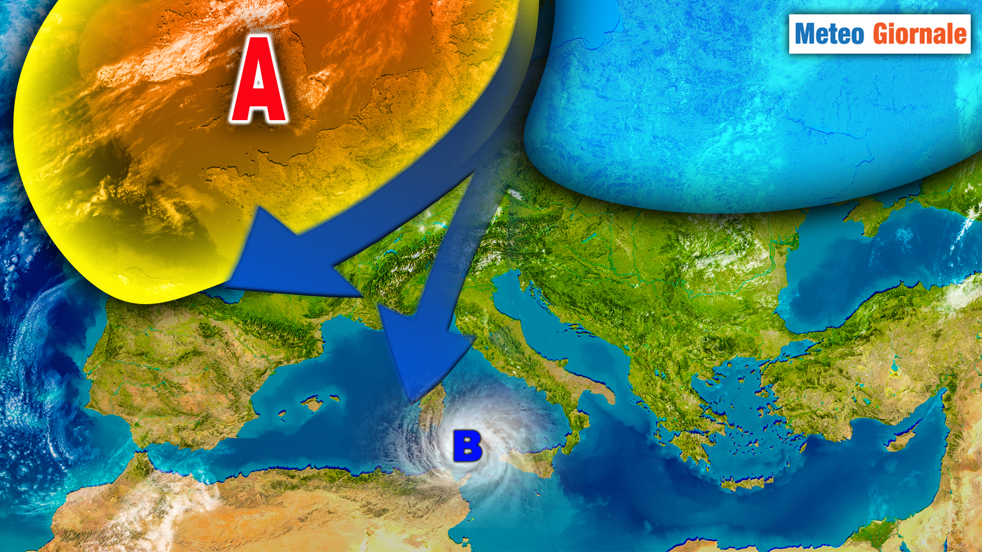
Over Central Europe, there is a vast high-pressure area with its core over the United Kingdom.
However, on its eastern edge, cold currents descend directly from the Pole towards the western part of our continent.
Part of these, however, manage to penetrate into the Mediterranean basin, fueling a persistent cyclonic circulation that will continue at least until Wednesday, disturbing the weather pattern over the two Main Islands and some areas of the Center-South.
In these areas, therefore, it will be advisable to keep an umbrella handy, as the risk of rain will remain high.
On Tuesday, the highest risk will affect Sicily and most of Sardinia, while on Wednesday the rains will leave Sardinia to concentrate on northern Sicily, also involving the South and some sectors of the Center, particularly lower Lazio, Abruzzo, and Molise.
A very different situation will be seen in the rest of the Center and especially in the North, where the weather will remain stable and even fairly sunny.
Exceptions will be the extreme regions of the Northwest, where the brief passage of a fast-moving cold air core, subsequently directed towards France, will bring some showers and even a bit of snow on the Alpine reliefs, at times even below 1000 meters of altitude.
From Thursday the 14th, the pressure will rise again over the Central Mediterranean basin and thus also over our country.
Apart from some residual instability still possible over Sicily and the Ionian sector, the atmosphere will return to stable conditions over the rest of the country, threatened only by the usual fog banks in the Po Valley and the more inland areas of the Center.
a note on temperatures.
During the day, there will be no significant variations, while at night it will get increasingly colder, particularly in the North and the inland valleys of the Center, with temperatures that may reach freezing levels, especially in the Po Valley and the Alpine valleys.
This weather context, if everything is confirmed, will accompany us for most of the weekend.
However, towards the end of Sunday, the first signs of a new change on the weather front may be noticed, which will become more evident at the beginning of the next week.
We will update you.


