

The second half of November could mark a turning point in Italy’s weather, bringing Autumn to give way to Winter more quickly than expected. As the end of the autumn season approaches, meteorological models are outlining a scenario of great instability on the European front. The influences of cold currents coming from the North clash with warm air masses coming from North Africa, creating a mix of conditions that could lead to a sharp drop in temperatures and a markedly winter climate.
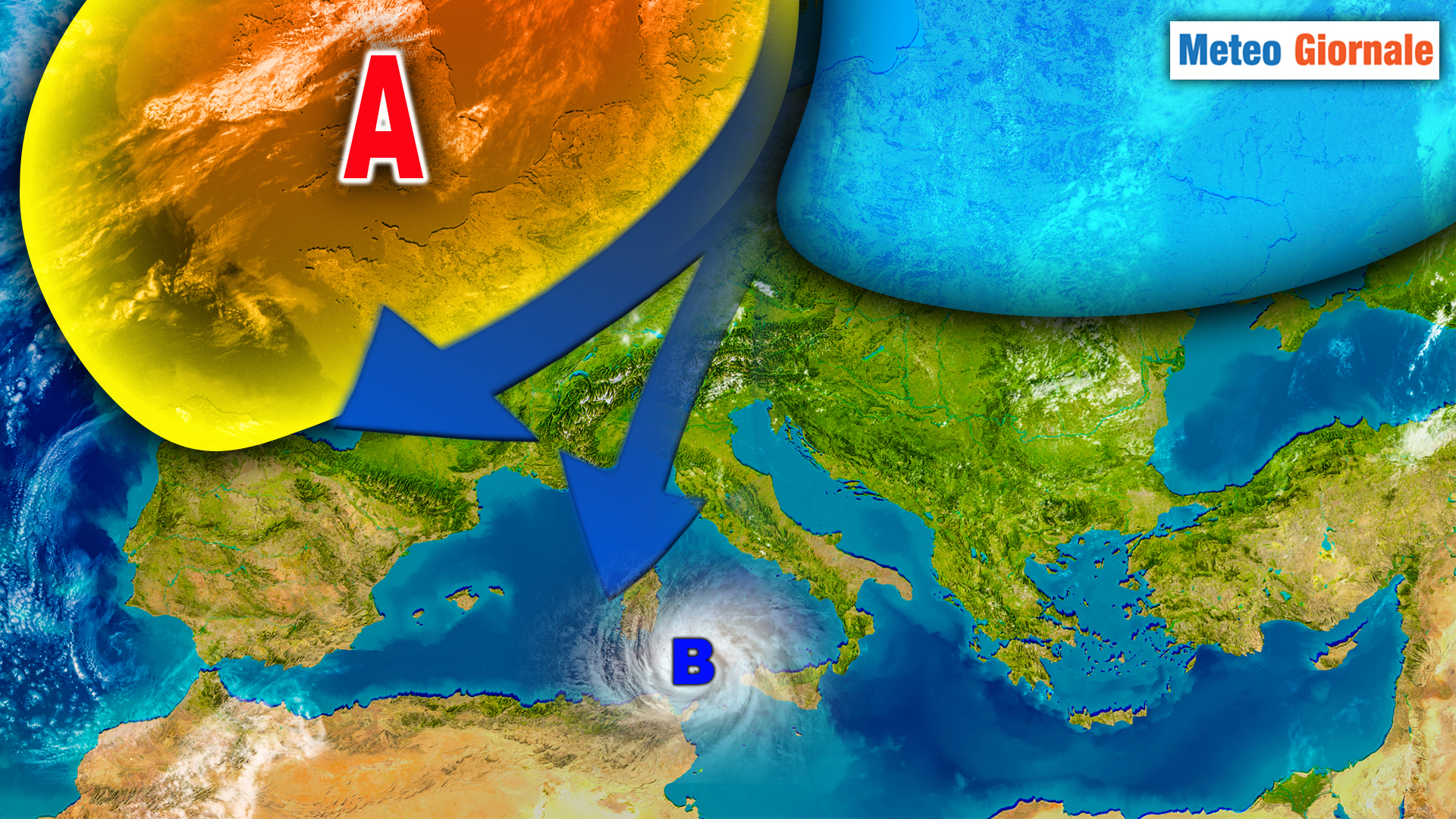
In recent days, a situation of notable atmospheric variability has been observed, with the alternation between moments of High Pressure that keep the climate mild and intrusions of cold air from Eastern Europe.
However, according to the latest projections, the third decade of November could be characterized by a sudden change, marked by the arrival of Arctic air that would push temperatures well below the seasonal average.
Arctic cold incoming: third decade of November under the lens
The real weather turning point could occur with the beginning of the third decade of the month.
According to the GFS (Global Forecast System) model, a significant disturbance is on the way that could bring a wave of icy air over Central Europe and, consequently, over Italy.
The expected split of the polar vortex could favor the entry of Arctic currents that would quickly slide towards the central Mediterranean.
If this scenario materializes, our country could face a sudden cold wave, with a drastic drop in temperatures.
The northern regions would be the first to be affected, with snowfalls in the Alps starting from 600-700 meters of altitude. Central Italy could also be affected by snowfalls in the Apennines, with the snow level possibly dropping to 900-1000 meters.
Snowfalls expected in the Apennines and possible surprises in the plains
The return of cold flows from the northern Atlantic could bring back scenarios typical of the harshest Winters, with snowfalls that could surprise many locations.
The Apennines, particularly those in Tuscany-Emilia and Abruzzo, could see the first significant snowfalls of the season. According to current forecasts, the snow level could drop below 900 meters, bringing accumulations even in hilly areas.
This sudden change would represent a valuable opportunity for ski resorts that, after a warm and dry Autumn, could finally see a return of natural snow.
The ski resorts of Abruzzo, Trentino, and Valle d’Aosta are awaiting a load of snow that could kick off the winter season early.
Be careful not to fall into certainty
Despite the evident signs of an imminent change, caution is still needed.
Long-term forecasts, especially when dealing with such complex atmospheric dynamics, are subject to sudden variations. The presence of the Azores High could further influence the scenario, leading to a possible reinforcement of warm currents and, therefore, an attenuation of cold waves.
However, if the polar vortex were to actually give way, the cold could have a more prolonged impact, turning Autumn 2024 into one of the harshest in recent years.
Italian cities could experience a return to conditions typical of a traditional Winter, with widespread frosts and possible snowfalls even in the plains, especially in the North.
The next two weeks will be crucial to understand if we are really heading towards an intense cold November or if Atlantic influences will manage to halt the advance of Arctic air. For now, the only certainty is that Italy is ready to experience a period of strong meteorological instability, where warm and cold will clash in an authentic climatic battle.


