
WEATHER UNTIL DECEMBER 4, 2024, ANALYSIS AND FORECAST
Humid westerly currents are affecting the weather in the Center-North, where clouds and some local rain linked to a weak front, which is significantly weakened by the presence of the anticyclone, are not lacking. Attention is focused on what awaits us in the second part of the week.
The novelty will be represented by the approach of a cold impulse from Northern Europe. The first signs of deterioration will begin to show at the end of Thursday 28, but starting from Friday 29 the cold vortex will come into full swing, ready to heavily affect the weekend when it will fully break through towards the Central Adriatic and then slide to the South.
There will be opportunities for full winter scenarios with snow locally reaching the hills in the Apennines. The drop in temperatures will be felt throughout Italy, further exacerbated by the intense cold northern winds.
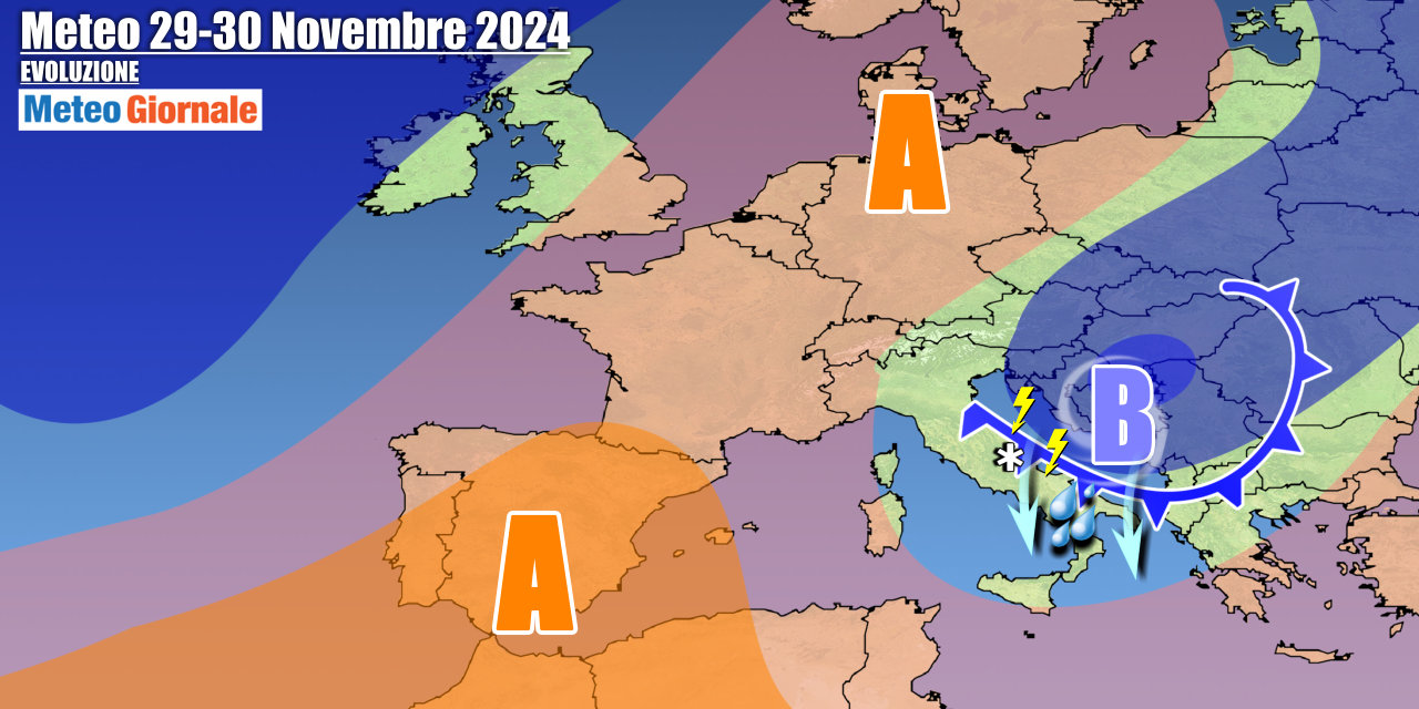
Between Saturday, November 30, and Sunday, December 1, the cold vortex will position itself in Southern Italy, with a well-structured cyclone in the lower layers over the Ionian Sea.
This will result in marked instability along the Adriatic slopes and in the South, with snowfalls on the hills at times. The cold circulation will then move eastward at the beginning of the week, directly involving Greece and Turkey.
In Italy, from the west, the anticyclone will begin to press, but it will still be a context of winter cold everywhere with lingering instability in parts of the South. Starting from Tuesday, December 3, Northern Italy could experience a return of milder Atlantic currents.
IN DETAIL
Thursday, November 28: the first part of the day will be mostly sunny, except for irregular and even compact clouds on the central and lower Tyrrhenian side.
In the evening, it worsens over the Alps and the North-East, with the first showers in the plains and snowfalls on the border sectors.
At night, it worsens over the central regions. Friday, November 29: the cold front will break into the Center-South, with some rain or showers on the central-lower Adriatic side and Campania, then extending towards the rest of the South.
Snow on the hills. Weekend: cyclonic vortex with precipitation between the Adriatic and the South.
Cold and snow expected in the hills. Further weather trends: the cold vortex will exit the scene and the anticyclone will return from the west, but new disturbed fronts from the Atlantic towards the North will loom.


