
WEATHER UNTIL AUGUST 18, 2024, ANALYSIS AND FORECAST
The beginning of the week of Ferragosto does not propose significant weather changes, with still the dominance of the African anticyclone not only over Italy but also over much of Central-Southern Europe.
Temperatures remain very high, with peaks around or just over 40 degrees, especially in some inland valleys of Central Italy and Sardinia.
The dominance of the anticyclone will last a little longer and will slightly weaken due to Atlantic infiltrations, which will bring a small trough over Western Europe.
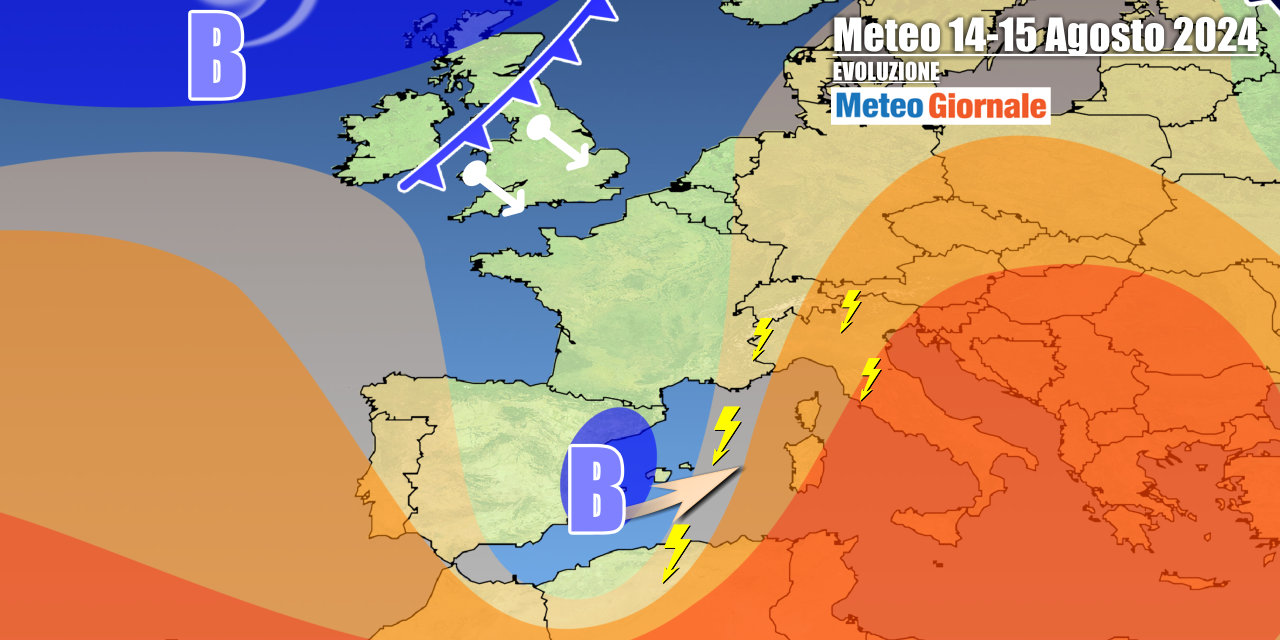
A vortex, filled with cool air, will intrude into the Mediterranean near the Balearic Islands, but will not significantly affect Italy until Ferragosto, apart from a certain increase in convective instability. Sardinia and the westernmost regions will be marginally affected by this cold drop from the west, which by the end of the week should advance more decisively eastwards. The Mediterranean vortex will be hooked by an Atlantic front, with worsening weather expected over the weekend starting from Northern Italy where more widespread thunderstorms will be observed. The disturbed impulse will be followed by cooler air, which should temper the heat first in the Center-North and then partly also in the South by Sunday, August 18.
The weekend cool down seems increasingly likely, although the extent of the temperature drop remains to be determined.
A return to a relatively normal situation is expected, at least temporarily.
IN DETAIL
Tuesday, August 13: stable and overall sunny weather, oppressive heat persists.
During the day, thunderstorms with heavy showers will form over the Alps and the Central-Northern Apennines, locally extending to adjacent areas. Wednesday, August 14: good weather except for thunderstorms over the Alps and Apennines, with local extensions to the northern plains.
Increasing clouds in Sardinia in the second part of the day. Thursday, Ferragosto: clouds over the Northwest and Sardinia, some rain.
Daytime thunderstorms over the mountains. Further weather trends: increasing instability especially over the weekend, with a tendency for widespread cooling starting from the northern regions.


