
WEATHER UNTIL MAY 4 2024, ANALYSIS AND FORECAST
The resurgence of the subtropical high-pressure system ensures a phase of stable weather that is now beginning to affect all of Italy, including the northern regions where there is still some instability, especially in the North-West. The North African anticyclonic ridge is channeling warmer subtropical air, with temperatures generally rising above average.
The beginning of the new week is expected to be hot with the push of the high-pressure system reaching its peak. Temperatures will also rise on the plains of the North, especially in the eastern Po Valley.
In some areas of the central-southern Tyrrhenian regions and on the two major islands, maximum values locally exceeding 28 degrees are expected. The progressive advance from the west of the Iberian depression will force the high-pressure system to fold back eastward.
A Mediterranean vortex will move from the Balearic Islands to Sardinia. The first rains will already reach the western regions from April 30, particularly the two major islands.
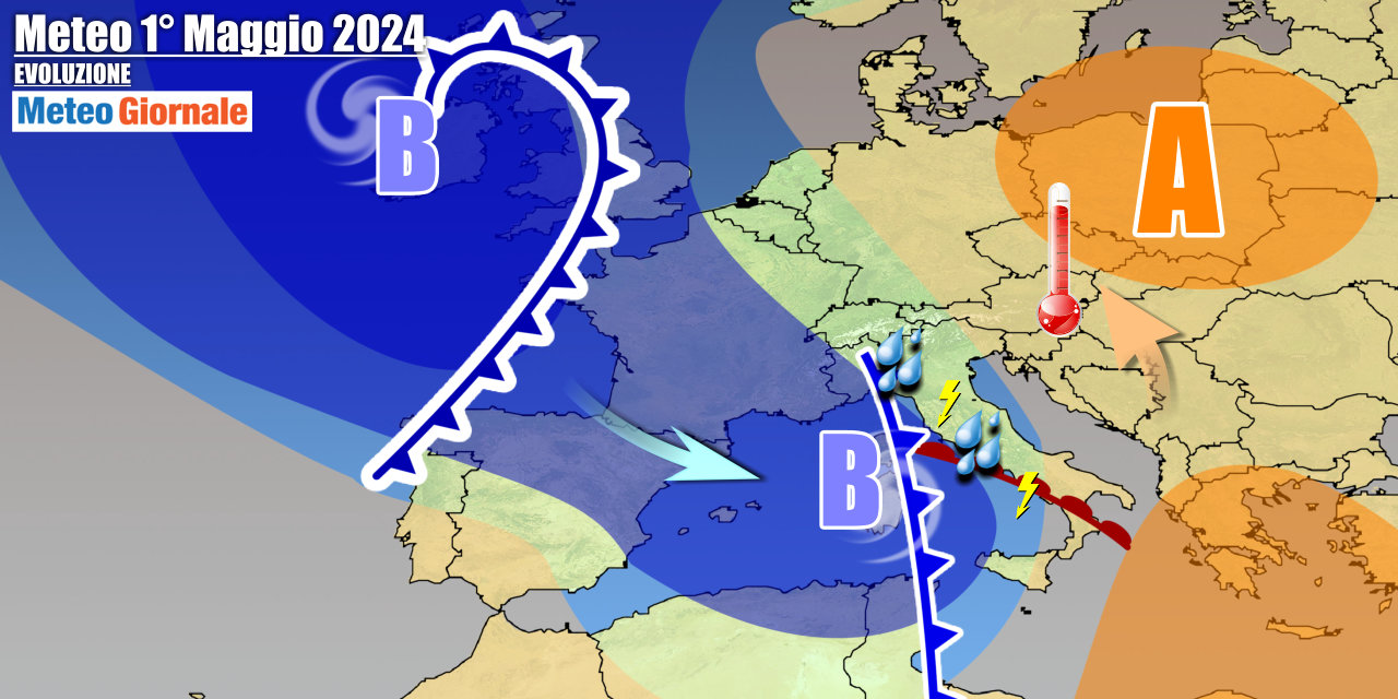
The deterioration will come into full swing on May 1st across much of Italy. Inevitably, temperatures will drop, as a result of the storm wave that may also manifest with heavy showers and thunderstorms. Further unstable impulses will reach Italy in the following days, with a disturbance expected in transit between May 2nd and 3rd, with a further decrease in temperature over the Central-North.
IN DETAIL
Monday, April 29: sunny weather, due to the African high-pressure system reaching its maximum expansion towards Italy.
The atmosphere will be locally hazy due to the presence of Saharan dust in suspension.
Occasionally dense clouds in the North-West, but without notable phenomena. Tuesday, April 30: in the second part of the day, worsening weather between the major islands and the North-West, with initial rains and thunderstorms.
Sun and almost summer-like heat in the rest of Italy. Wednesday, May 1st: unstable across much of Italy, with rain, thunderstorms, and a drop in temperature. Further weather trends: a new front will reach the Peninsula between May 2nd and 3rd, and generally, the first part of the month will be intermittently unstable with temperatures more or less aligned with typical values for the period.


