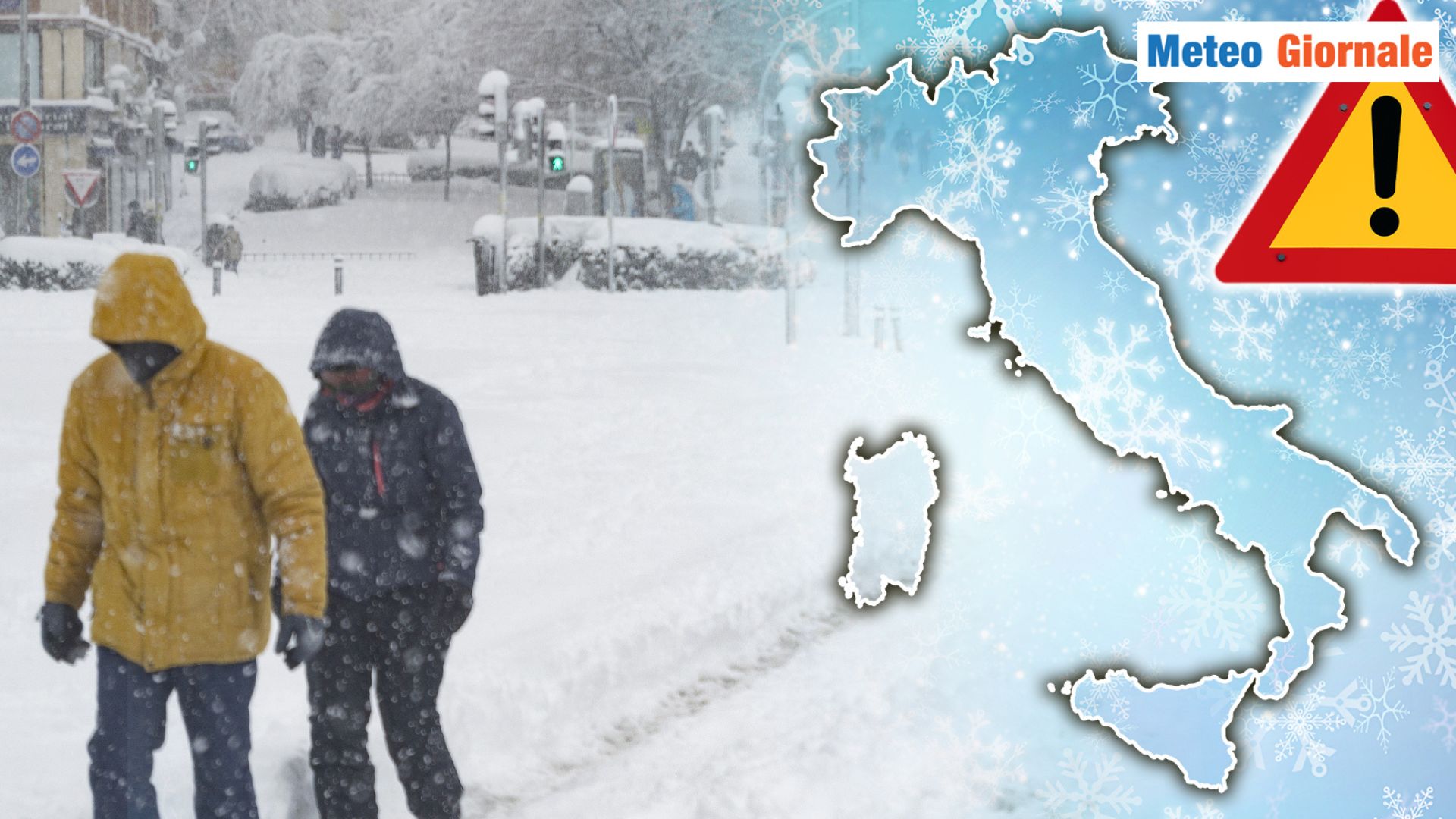
 A weakening of the Polar Vortex could generate a significant cold wave in Italy by the end of November.
The Polar Vortex is a vast area of low pressure present above the North Pole, surrounded by intense winds that rotate counterclockwise.
Its main function is to keep the frigid air confined to the polar regions.
When the Vortex is stable and well-organized, it can contain the cold air, allowing the rest of the Northern Hemisphere to experience milder conditions.
However, when the Polar Vortex weakens, this structure can break down, allowing Arctic air to push southward. The causes of this weakening are often linked to stratospheric warming phenomena, called Sudden Stratospheric Warming (SSW), which occur in the polar stratosphere.
These warming events can destabilize the Polar Vortex, altering its structure and reducing the strength of the winds that usually confine the cold air to the polar zones.
As a result, the Vortex can fragment or shift, allowing masses of Arctic air to move southward, across Europe and into the Mediterranean. When the polar cold air manages to descend to lower latitudes, it interacts with the orography of the European continent.
In the presence of a weak Polar Vortex, the jet stream, which normally flows straight from west to east, tends to take on a more wavy pattern.
This phenomenon, called “meridionalization,” allows the cold air to slide along the waves of the jet stream, thus reaching Italy.
The Alps and the Apennines, which lie along the path of the cold air masses, facilitate the channeling of this air towards the Italian plains and coasts, amplifying the impact of cold waves on much of the country. An Arctic incursion can also lead to atmospheric instability phenomena as the cold air arriving from the north clashes with the milder and more humid air present over the Mediterranean.
This thermal contrast creates favorable conditions for the formation of clouds and precipitation, with the possibility of low-altitude snowfall, even in non-mountainous areas.
The cold air coming from the polar regions is generally very dry, but as it crosses the Mediterranean, it becomes enriched with moisture, giving rise to intense and widespread snowfall that can even reach the coasts. Current atmospheric conditions suggest that the Polar Vortex could undergo a progressive weakening during the month of November, creating the conditions for an early cold event.
Some climate models indeed indicate pressure anomalies over the Atlantic and Europe, which would favor the influx of polar air southward.
The high-pressure currents present over the Atlantic could “block” the flow of westerly currents, creating an ideal configuration for the development of cold incursions directed towards the Mediterranean. Moreover, current atmospheric oscillations, such as the North Atlantic Oscillation (NAO), can amplify these effects.
A negative NAO, for example, is associated with low-pressure conditions over southern Europe and high pressure to the north, further facilitating the descent of cold air towards Italy.
If this configuration were to persist for a sufficiently long period, our country could be exposed to a sequence of Arctic incursions, with early winter conditions already in November. The weakening of the Polar Vortex is a scenario that can favor the influx of frigid air from the Arctic to Italy, bringing harsh climatic conditions and snowfall even at low altitudes.
The situation is being closely monitored by meteorologists, as current baric anomalies suggest a particularly dynamic winter, characterized by possible episodes of intense cold already in advance of the normal seasonal trend.

Early cold waves on the way? WEATHER under close observation
Our articles from Meteo Giornale are on Google News, follow us for free!


