

High Pressure Dominance Continues for a Long Time
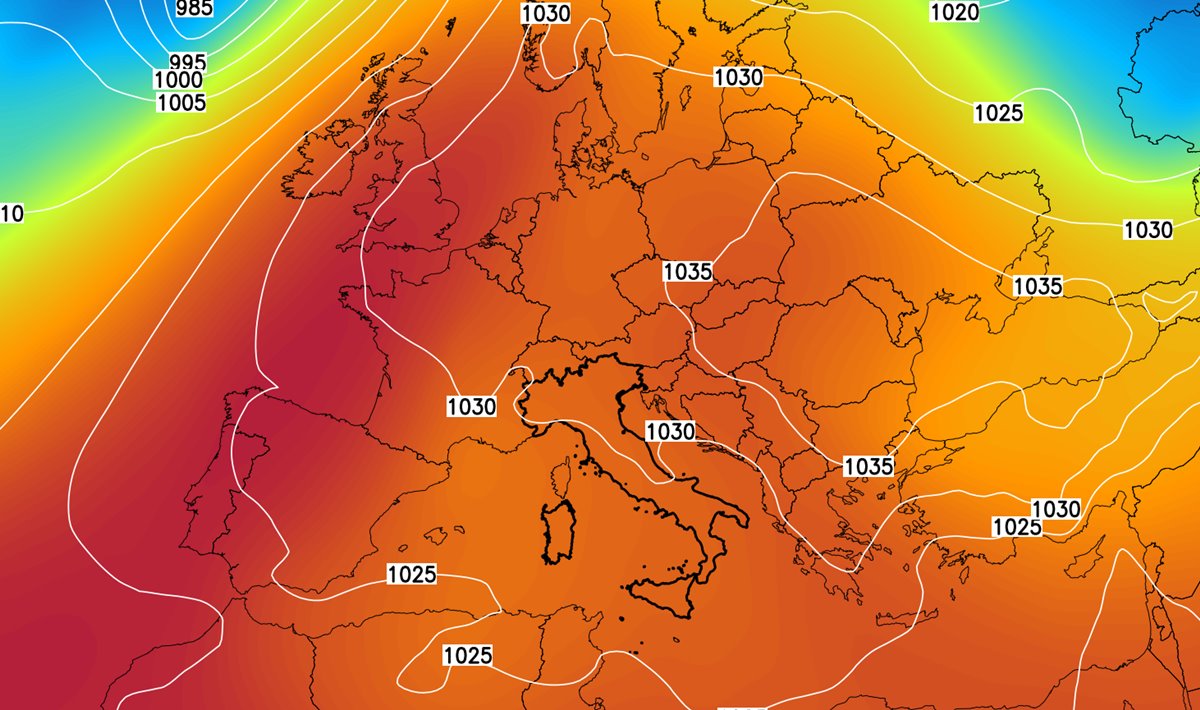
Italy is currently experiencing a solid high-pressure field that is ensuring stable atmospheric conditions across the entire territory.
This anticyclonic dominance, which has already brought stable weather in recent days, will continue virtually unchallenged in this early phase of November.
At least until the 5th of the month, no significant changes are expected: high pressure will remain dominant, ensuring generally clear or slightly cloudy skies.
However, this stable atmospheric scenario leads to the formation of widespread fog and mist, especially in the northern plains, but also at times in the internal valleys of the Center-South, where these conditions will significantly reduce visibility, especially during the colder hours. Thanks to the anticyclone, the climate will remain quite mild during the day, with temperatures slightly above the seasonal average in sunny areas, while in areas where fog (or low clouds) persist, thermal values will remain contained.
This atmospheric pattern indeed favors a significant thermal excursion, with relatively cool nights and warm days, where temperatures tend to rise considerably during the central hours of the day.
Partial Barometric Decline After November 5th
According to the latest updates from weather models, starting from the period November 6-8, we might witness a first, albeit partial weakening of the anticyclone over the Mediterranean area.
This would involve a drop in geopotential heights, which could favor a modest worsening of the weather in some parts of the Peninsula.
In particular, scattered showers and thunderstorms could form over the Tyrrhenian regions and specifically over the major islands.
Even the peninsular Italy, especially the central-southern Tyrrhenian areas, could experience an increase in cloudiness, although conditions would remain generally stable due to still high atmospheric pressure.
Could lead to atmospheric instability especially over the Major Islands
A more unstable scenario, with a possible more incisive attack on the anticyclone, could occur later, towards the end of the first decade of November.
It is hypothesized that unstable impulses associated with colder air masses coming from the northeast could break the anticyclonic dominance and bring conditions of more marked bad weather.
However, this remains for now only a hypothesis: the next updates will allow for a better assessment of the actual realization of this scenario.


