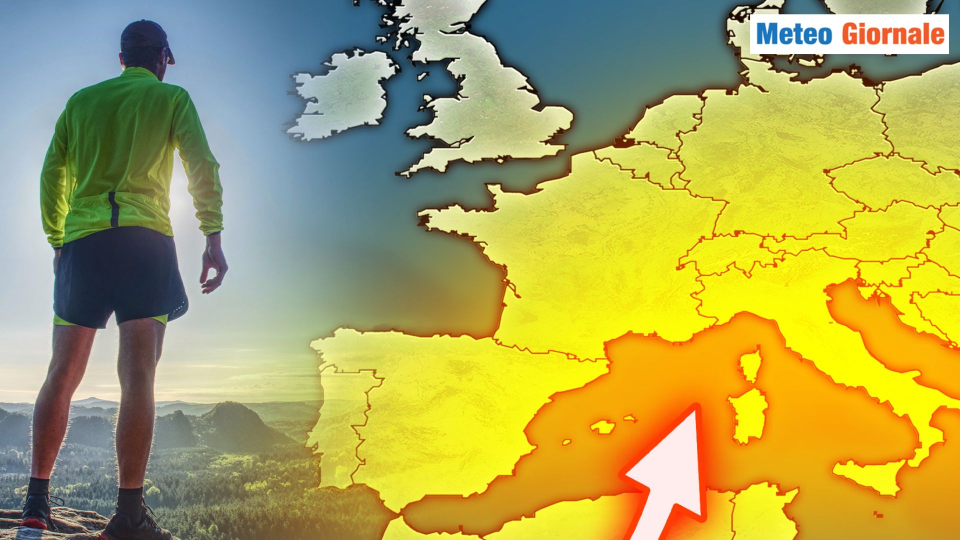
 For the week from November 1 to 7, 2024, Italy is preparing for predominantly stable and mild weather, thanks to the presence of a robust anticyclone, which will significantly influence atmospheric conditions over much of the country.
During the first days, the anticyclone will maintain clear or slightly cloudy conditions in almost all regions, with temperatures above the seasonal average, particularly in the Center-South and the major islands.
This period will therefore see maximum temperatures between 22 and 24°C in the central and southern regions, rather high values for November, offering a last taste of almost late-summer weather. The northern plains, as often happens during autumn anticyclonic phases, may experience widespread morning fog, especially in the Po Valley. This phenomenon is due to the typical thermal inversions of the period, which favor the accumulation of humidity and the formation of mists, making the mornings often gray and colder compared to the central hours of the day, when the sun manages to dissipate the fog.
However, as the end of the week approaches, a possible break in this stable regime is outlined.
Towards November 7, in fact, Atlantic currents could begin to brush northern Italy, with a weak disturbance that risks changing the weather picture, bringing the first hints of scattered rains and a slight drop in temperatures. From November 1 to 6, therefore, mostly clear or slightly veiled skies can be expected in all regions.
Temperatures will remain mild for the period, with maximum peaks that could exceed 20°C, especially in Lazio, Campania, and Sicily, where conditions will still be almost summer-like during the daytime.
Winds will be predominantly weak or moderate from the north, without particular disturbances for the seas, which will be slightly rough or locally rough on the Adriatic and Ionian basins.
In the major islands, Sardinia and Sicily, maximum temperatures could reach 25°C in the inland areas and the more protected sectors, with predominantly clear or only partially cloudy skies.
In the morning, possible veils will also affect Calabria and Molise, though without significant effects. The change of scenario expected for November 7 remains uncertain and will depend on the evolution of the Atlantic currents.
If these intensify, a weak disturbance could cross the North and then descend towards the Center, bringing a temporary worsening and a drop in temperatures, which would approach the seasonal averages, especially in the northern regions and particularly in the Alpine and pre-Alpine areas.
However, the uncertainty is still high, and it is not excluded that the effect of the disturbance could be marginal, limited to scattered clouds and light rains, especially in Liguria and the upper Tyrrhenian side. This autumn phase, on the whole, will therefore be characterized by above-normal temperatures and dry conditions, in line with the trends of recent months, which have often seen a prolongation of mild weather beyond the beginning of November.
Only the northern plains could present slightly cooler weather, especially in the morning, due to the fog, but the maximum temperatures will still remain above average.
Nighttime minimums, on the other hand, could record greater drops in the inland and hilly areas of the Center-North, with values dropping to 8-10°C in the valleys, favoring cooler weather at dawn. the Italian climate in this first week of November 2024 will be dominated by high pressure and unusually high temperatures for the period, with clear or slightly cloudy skies for most of the time.
Only towards the end of the week will a deterioration be possible, but its impact is still unclear and will need to be monitored.

Italy under the Anticyclone: clear WEATHER and unusually mild temperatures
Our articles from Meteo Giornale are on Google News, follow us for free!


