 POSSIBLE WEATHER EVOLUTION OVER 15 DAYS Observing the mathematical models, we can only acknowledge the imminent climatic weather turnaround.
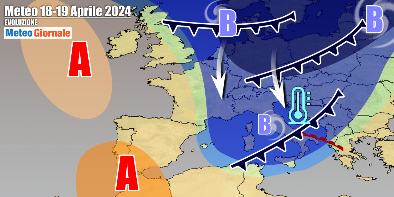
It is appropriate to define it as such because it will be a real upheaval, indeed we will move from abnormal heat to a climate scenario not far from Winter. This means it will be cold, so much so that most thermal projections tell us that temperatures could stay below seasonal averages for several days.
Considering that until a few days ago we were talking about something completely different, it is clear that defining it as a seasonal shift is fitting. Moreover, cards on the table, it could be a shift that affects the entire second half of April. SHORT-TERM WEATHER The weather is already showing clear signs of change, indeed the imminent arrival of cold air from the north is causing a progressive increase in atmospheric instability. Instability that during the middle of the week will take hold almost everywhere and could lead to locally intense phenomena due to the significant thermal contrasts that are developing. It is worth noting the return of heavy snow on the Alpine arc and also the snowfalls that will cover the Apennines. NORMALITY In the previous analysis, we highlighted how this change is absolutely normal considering that the current spring phase can be deemed the most turbulent of all. A phase that, as written at the beginning, could continue throughout the entire second half of April as the projections of the mathematical models suggest a persistent cyclonic circulation – of a cold nature – over Eastern Europe with more or less direct involvement of the central Mediterranean. IN CONCLUSION In short, the conditions are being set for a decidedly turbulent second half of the month, as befits April. We remind you that weather forecasts with a validity of up to 5 days are more reliable, while this reliability decreases as we move further in time.

Weather forecast for 15 days, turbulent second half of April
Our articles from Meteo Giornale are on Google News, follow us for free!


