
WEATHER UNTIL DECEMBER 17, 2024, ANALYSIS AND FORECAST
The influence of the Mediterranean vortex positioned over Central Italy has not yet subsided, with still unstable weather over much of Italy.
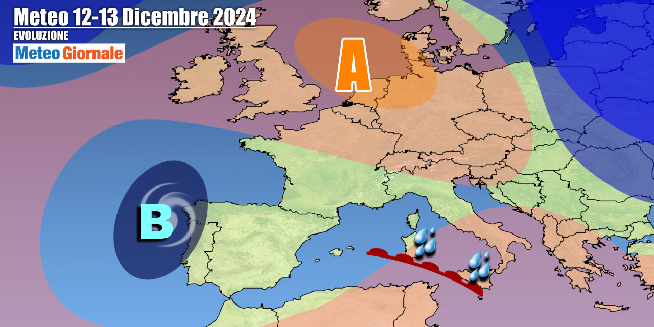
The strengthening of the anticyclone over Northern Europe determines the isolation of a vast depressionary area at our latitudes from the Balkans to Spain, with several associated pressure minima, although it tends to lose energy gradually. The main core of the depression will shift more towards the Iberian Peninsula during midweek, but it will continue to cause local instability in the Center-South.
The contrasts between the pre-existing cold air and more temperate currents of Afro-Mediterranean origin will still feed the vortex, while temperatures will rise slightly due to the absence of new cold air flows. Between Thursday, December 12 and Friday, December 13, a new perturbation impulse will revive over the Western Mediterranean to move towards the two Major Islands and then part of the Center-South, with a new load of rain.
This phase of instability should also extend into the next weekend, when a quick passage of a cold front from Northern Europe cannot be ruled out. The weather will deteriorate again, particularly along the Adriatic regions and the South, while colder air could slightly lower temperatures, with some snowfall in the Apennines. Northern Italy should remain more sheltered and with predominantly dry conditions, awaiting the anticyclone to conquer most of Italy at the beginning of next week.
IN DETAIL
Wednesday, December 11: still a lot of variability in the Center-South, with more occasional precipitation more frequent between Campania, Lucania, and Calabria.
It will be better in the rest of Italy, with more clearings in the North, although there may be some residual light rain in Romagna. Thursday, December 12: worsening again over the Major Islands, with rain and thunderstorms, subsequently extending to Lower Calabria.
Mostly harmless clouds over the rest of the country. Friday, December 13: showers and some thunderstorms between the Islands and the extreme South, then also on the Tyrrhenian. Further weather trends: over the weekend, a new cold impulse from the north could arrive to revive instability with greater effects on parts of the central-southern regions.


