
WEATHER UNTIL DECEMBER 21, 2024, ANALYSIS AND FORECAST
The phase of unstable weather continues over Italy, with what remains of the Mediterranean depression fueled by a front of colder air from Northern Europe. Showers and thunderstorms will persist on Sunday over parts of the Center-South, while the weather will temporarily improve starting from Northern Italy where the push of the Anticyclone expanding from the west will begin to be felt. Colder air will cause temperatures to drop a bit on Sunday, with some snowfall in the Apennines down to medium altitudes.
The cooling will be exacerbated by strengthening winds from the northern quadrants.
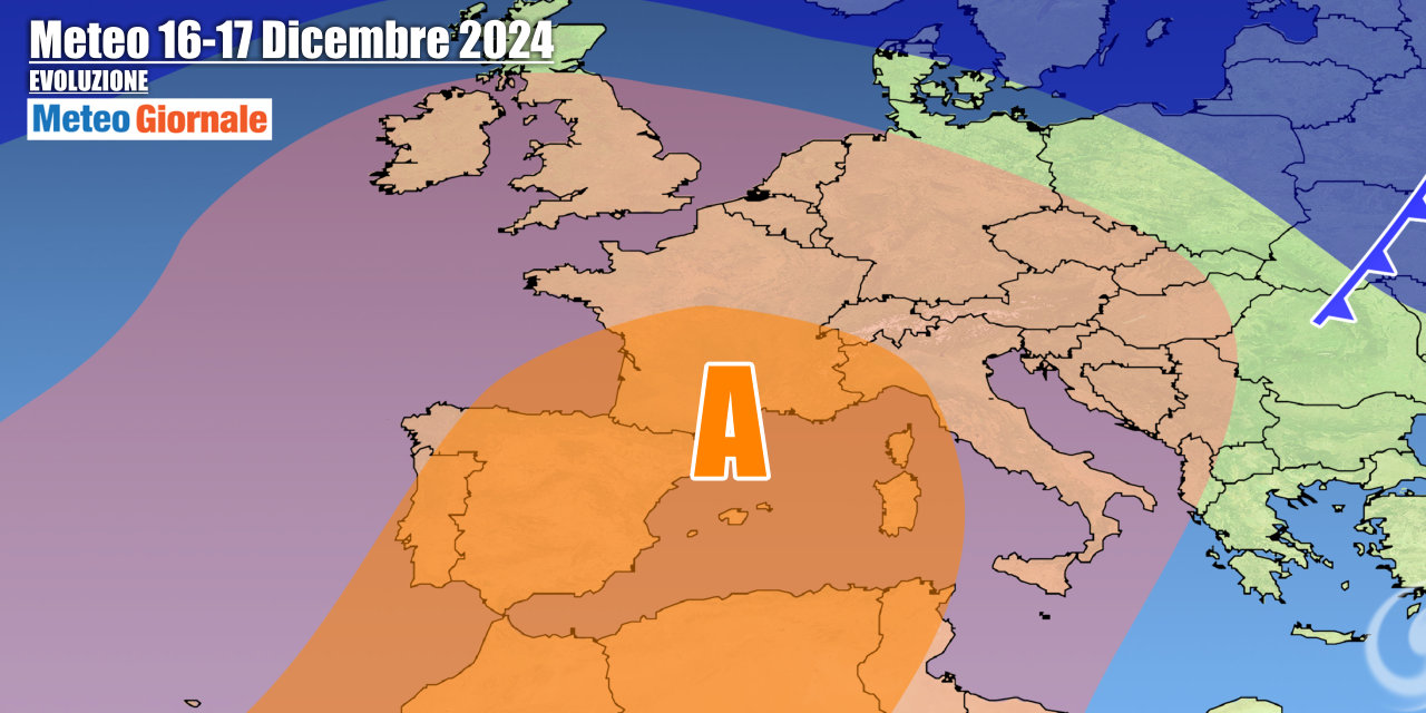
Important news is confirmed from the beginning of next week, the one that will lead us towards Christmas, thanks to the establishment of a robust anticyclonic field over Italy. A period of stability should establish itself over the entire country, with no rain and mostly sunny weather except for fog in the Po Valley. Temperatures will rise in the highlands with the freezing level reaching over 9842 feet. This anticyclonic phase should reach its peak around Wednesday the 18th.
There will therefore be a few days of winter dormancy. A sharp decline of the anticyclone is expected from December 19-20, with the passage of a first Atlantic front that could be followed by another impulse over the weekend of the 21st-22nd.
Instability and relatively cold weather could also characterize the days leading up to Christmas, although a return of the Anticyclone is not ruled out right in time for the Holidays.
IN DETAIL
Sunday, December 15: the cold and unstable impulse will move towards the South with scattered showers and snowfall in the Apennines starting from 3937 feet. Residual phenomena also between Lazio and Abruzzo, snowy on the reliefs from 3281 feet.
Lots of sun over the rest of Italy, some fog in the Po Valley. Monday, December 16: the anticyclone consolidates bringing stable weather, improving also in the South.
More fog in the Po Valley.
Temperatures rising at altitude. Tuesday, December 17: Anticyclone dominance with mostly sunny weather and lots of fog in the Po Valley. Further weather trends: the anticyclone will begin to weaken.
First disturbances from Thursday the 19th, when Atlantic currents will return with rain arriving in the central-northern regions.


