
WEATHER UNTIL DECEMBER 27, 2024, ANALYSIS AND FORECAST
Part of Italy is dealing with adverse weather due to a deep cyclonic vortex causing winter weather.
Cold air from Northern Europe accompanies the vortex, which quickly tends to move towards the South and exit the scene.
Therefore, we expect an improvement for the start of the weekend, apart from the last phenomena in the extreme South.
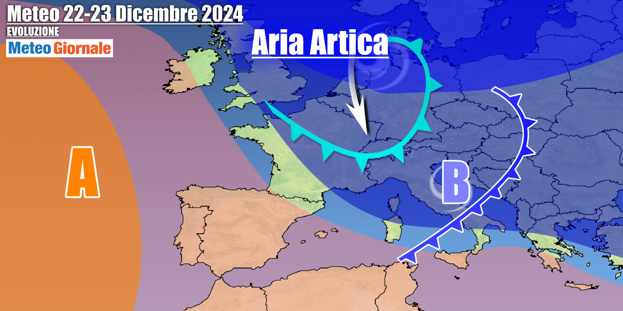
The cold will be felt due to still northern winds. This pause will be short-lived. A new front will reach Italy on Sunday, the 22nd.
The trajectory of this further disturbed impulse will favor the Center-South, with more rain and mountain snow in the afternoon.
The North will be almost skipped by the disturbance, with only a few showers and snowfalls on the border Alps where we will have locally significant accumulations. Arctic air currents will begin to flow at the beginning of the week towards Italy, sliding along the eastern edge of the anticyclone located over Western Europe. This cold intrusion will contribute to a new and sharp temperature drop, with initially polar-origin air followed by colder arctic-origin contributions. The maximum effects are expected between December 24 and 25, in what will be a more pronounced winter phase on the Adriatic and the South where there will be instability with low-altitude snow.
The weather will be sunnier in the rest of Italy.
This winter context will persist also on the 26th, but with instability starting to wane thanks to the gradual push from the west of the anticyclone.
IN DETAIL
Saturday, December 21: residual precipitation in Puglia and the Lower Tyrrhenian, but quickly ending.
Winds are easing, it will still be cold with morning frosts in the North and inland areas of Central Italy.
The sun will dominate almost everywhere during the day, but with veils arriving towards the North. Sunday, December 22: a new front enters with snow in the Alps and rain in the afternoon in the central regions, extending to the Tyrrhenian areas of the South.
Winds strengthening again from the west. Monday, December 23: winter phase due to cold air from the north, with instability between the Adriatic and the South. Further weather trends: a trough, fed by arctic air, will maintain a winter framework also for Christmas and St.
Stephen’s days.
We expect more pronounced instability along the Adriatic slopes and in the South where there will be snowfalls even in the hills.


